
Customized high resolution weather simulations
High resolution weather models for any location in the world, both operationally or for specific simulations. Advance knowledge of weather conditions will help better operational planning and save costs. In case of extreme events it will improve safety and reduce risks. This product is necessary in areas with severe weather conditions, such as high altitude mining operations, mountaineering and adventure expeditions and will improve management in mountain resorts.
This product is designed for company meteorologists or meteorology trained personnel, to complement, not substitute their tasks.
- Plan ahead of weather events
- Minimize disruption
- Prevent road blocks by snow
- Forecast operating window for wind sensitive tasks
- Schedule blasting and transport to minimise environmental impact
- Improve personnel safety
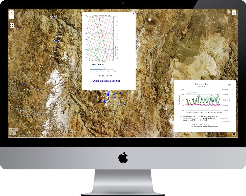
Check our demo site for the Andes.
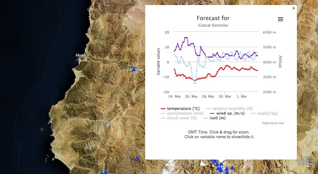
Demo site for the Andes, better with high speed broadband.
Visualization example, click to animate. Wind speed at 100 m above ground at the Noor 3 thermosolar power plant in Morocco.
Case studies
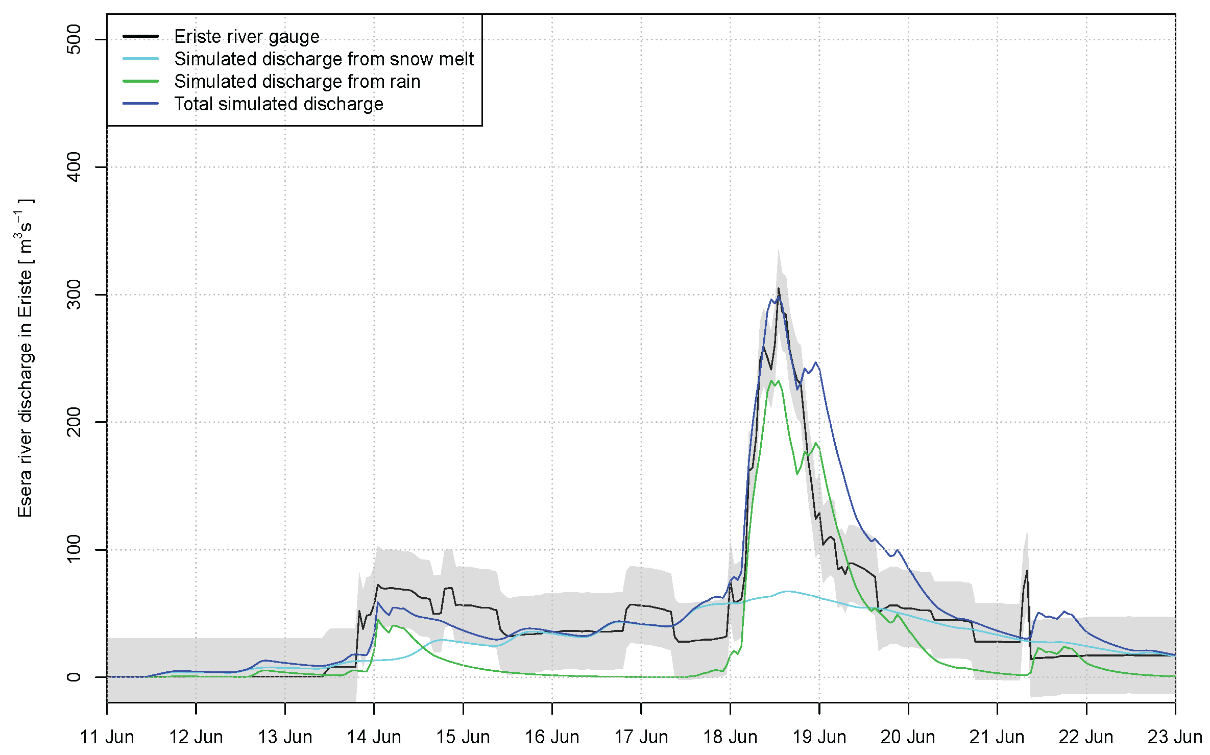 | 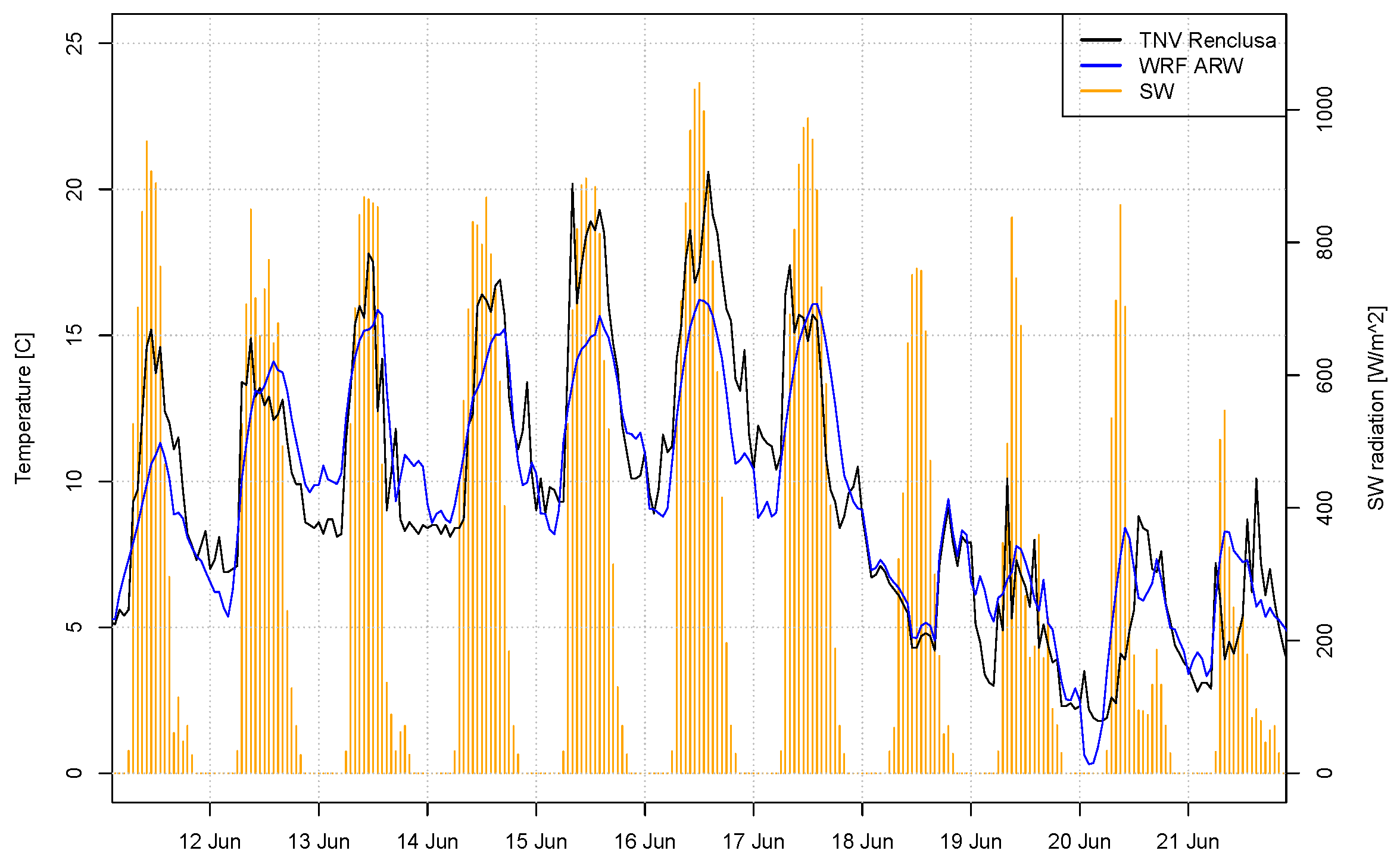 |
Peak flow estimation from WRF input during floods in the Pyrenees. From our paper: Corripio, J. G., and J. I. López-moreno (2017), Analysis and Predictability of the Hydrological Response of Mountain Catchments to Heavy Rain on Snow Events : A Case study in the Spanish Pyrenees, Hidrology, 4(2), 20, doi:10.3390/hydrology4020020. Link and pdf.
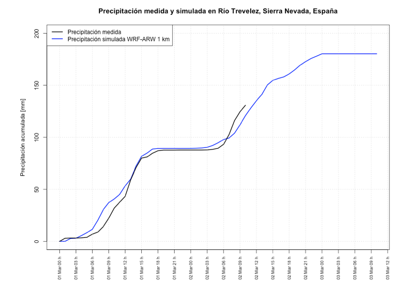
Simulated and measured precipitation during torrential rains in Sierra Nevada.
The importance of resolution
On mountain regions the resolution of the model is important in order to simulate the impact of topography on weather systems. At 0.25° or 0.50° resolution, global models do not represent mountain ranges accurately, missing the highest elevation by thousands of meters. It is therefore necessary to downscale the results using models that can run over a smaller region but at higher resolution.
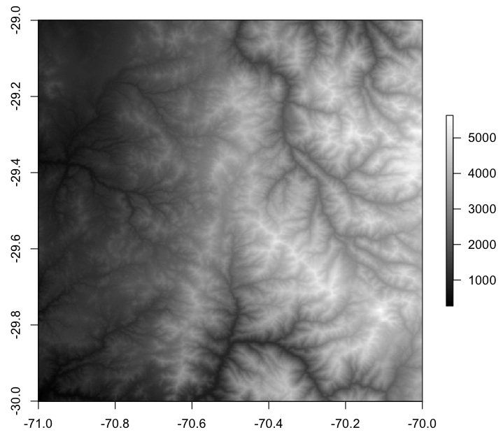
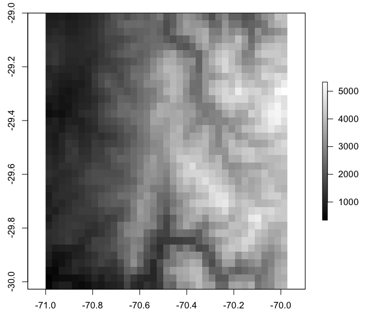
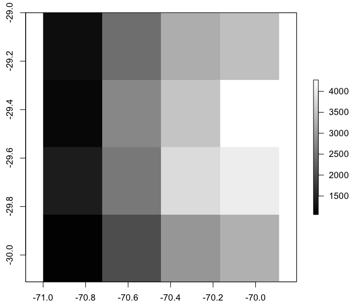
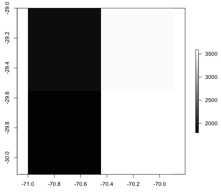
An example of the importance of resolution is illustrated in Figure 1. As resolution decreases, the relief is smoothed and elevation decreases. Weather models at lower resolution cannot discriminate the impact of mountains, such as wind drag, wind channelling, orographic precipitation, etc. and therefore are less reliable than higher resolution models.
 |  |
| a) 30 m | b) 3 km |
 |  |
| c) 30 km | d) 60 km |
Figure 1 Digital Elevation Model at different resolution (30 m, 3 km, 30 km and 60 km). Note the highest elevation is in excess of 5000 m at 30 m and 3km, and only 3500 m at 60 km resolution.
These differences in resolution have a strong impact when modelling wind speed as seen in Figure 2. Note how the WRF, on the right panel, can identify individual valleys and how the wind streams follow the main valleys. This in turn will affect wind velocity and therefore wind energy forecast, wind potential or the exposure of workers in operations at high altitude.
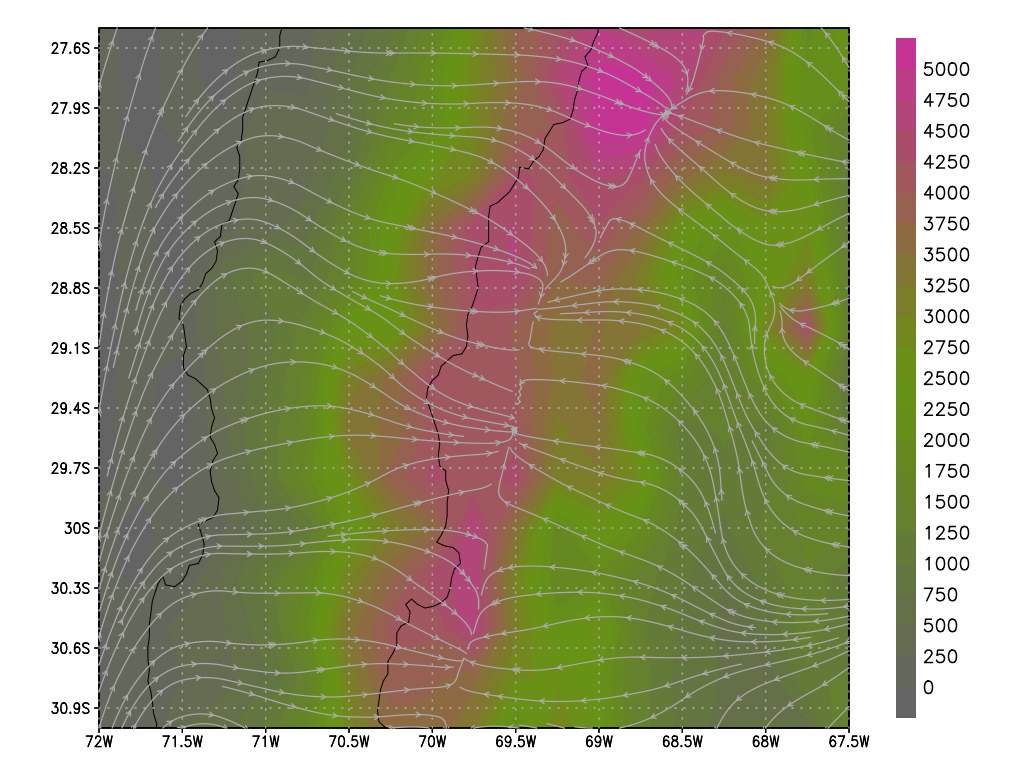 | 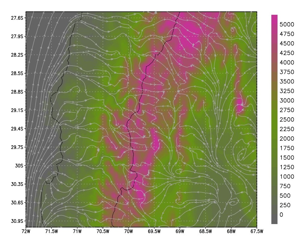 |
| a) GFS 0p25 | b) WRF 4 km |
Figure 2. Surface elevation and wind streams over the Arid Andes of Chile and Argentina. On the left panel a GFS simulation at 0.25° resolution, on the right panel a WRF simulation at 3km resolution.
High resolution modelling also have advantages when simulating solar energy, precipitation, snow melt and runoff and many other meteorological parameters.
We can offer the results in a user friendly, interactive platform, that allows a rapid evaluation and fast response.
 |
Please contact us for more details if you need to run a high resolution simulation.