At meteoexploration.com we focus on:
- GIS developement
- Data analysis and spatial modelling
- Photogrametry and georeferencing oblique photography
 |
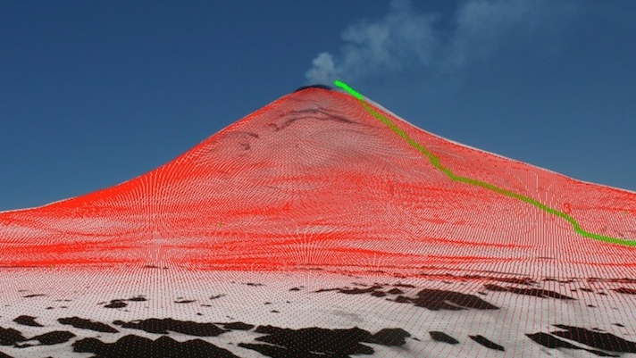 |
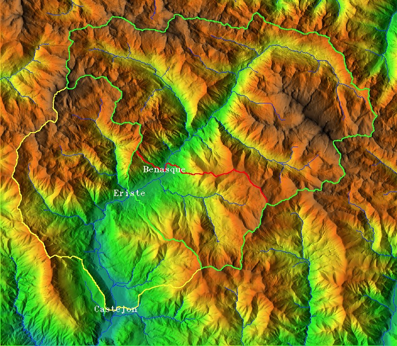
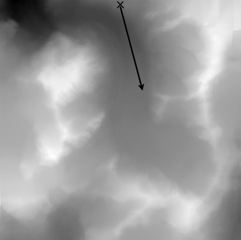
| GIS catchment extraction for snow runoff monitoring in the Pyrenees. | GPS track and georeferenced DEM to Volcan Villarica, Chile. |
We have developed specialized tools for monitoring short term environmental change. We can apply the information derived from remote sensing, GIS applications and in situ measurements to monitor snow cover, glacier variations, vegetation cover and habitat changes, especially in mountain regions.
Current projects:
Past projects:
- Glacier velocity and retreat in Patagonia
- Monitoring ice capped Volcano Villarrica
- Snow wind drift model validation in avalanche research
Other companies and institutions using our tools
Georeferencing Photography
Georeferencing oblique photography is a process for mapping the information contained in the image pixels to the corresponding grid of a digital elevation model. This process allows to make effective use of the information contained in a photograph and its precise relationship to real world coordinates. Here we describe the background theory and provide a user friendly software tool that makes the process simple and efficient.
Background theory
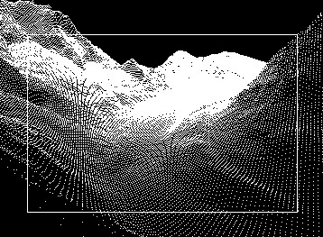
A straightforward way to relate an oblique photograph to a DEM (digital elevation model) is reproducing the viewing geometry of the camera through a mathematical transformation of the DEM. This is like making a virtual photograph of the DEM, that is, replicating how the terrain would be seen from the point of view of the camera. In this way we can compare real and 'virtual' photograph and map one onto the other.
Thus, from the original photograph, plus the DEM:
 |
||
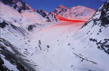
| Figure 5.- Resulting map of georeferenced reflectance values. This image is taken later in the season than in Figure 4, the snow-free ice tongue of the glacier is appearing on the left side of the image. See the second animation, below, for the ability of the tool to identify small details. |
How the software tool works
Here is a video of the tool in action through a user friendly GUI:
Time progress:
| 00:00:00 | Settings can be provided directly or archived in a file. |
| 00:00:10 | Data are loaded according to the settings: DEM, visibility, image, camera coordinates film or sensor characteristics and ground control points (GCP). |
| 00:00:14 | GCP are plotted on the image for verification. |
| 00:00:17 | The image can be zoomed for fine corrections. |
| 00:00:28 | Viewing transformations and a perspective projection are applied to the DEM. |
| 00:00:36 | The transformed DEM is superimposed on the original photograph. |
| 00:00:42 | Once the DEM and the photograph agree, the pixels from the image are extracted and mapped onto the DEM, resulting in a georeferenced image. |
Applications
This tool can be used to monitor land cover change at a very high temporal and spatial resolution. Potential uses are:
- Snow avalanches
- Snow cover and snow line
- Land slides
- Reforestation
- Landscape evaluation
- Volcanic ashes dispersion
- River channel morphology and change
- etc.
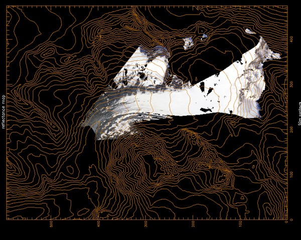
Below is an example to determine the position of proglacial channels of the Arolla river and their daily variations. The same set of images have been used to map snow cover, derive the albedo of snow and ice and supplement the information for a model of snow melt and water production.
The image above is not an aerial photograph, but derived from the images taken by the camera inside the box in Figure 1.
Paper describing all the details and transformations:
Corripio, J. G.: 2004, Snow surface albedo estimation using terrestrial photography, International Journal of Remote Sensing . 25(24), 5705–5729. pdf
Some additional articles, users and applications:
Corripio, J. G.: 2003, Vectorial algebra algorithms for calculating terrain parameters from DEMs and the position of the sun for solar radiation modelling in mountainous terrain, International Journal of Geographical Information Science 17(1), 1–23. pdf
Corripio, J. G., Durand, Y., Guyomarc’h, G., Mérindol, L., Lecorps, D. and Pugliése, P: 2004, Land-based remote sensing of snow for the validation of a snow transport model, Cold Region Science and Technology. 39(2-3), 93–104. pdf
Durand, Y., Guyomarc'h, G., Mérindol, L. and Corripio, J. G.: 2003, 2D numerical modelling of surface wind velocity and associated snow drift effects over complex mountainous oragraphy, Annals of Glaciology, 38, 59-70.
Durand, Y., Guyomarc'h, G., Mérindol, L. and Corripio, J. G., 2005: Improvement of a numerical snow drift model and field valaidation. Cold Region Science and Technology 43, 93-103. pdf
M. Dumont, Y. Arnaud, D. Six and J.G. Corripio.: 2009, Retrieval of glacier surface albedo using terrestrial photography. Détermination de l’albédo de surface des glaciers à partir de photographies terrestres. La Houille Blanche, 2, 102-108 pdf
Daniel Farinotti, Jan Magnusson, Matthias Huss and Andreas Bauder: 2007 Snow accumulation distribution inferred from time-lapse photography and simple modelling. Journal of Geophysical Research (2010): F01014 pdf
Grêt-Regamey A, Bishop I D, Bebi P, 2007, Predicting the scenic beauty value of mapped landscape changes in a mountainous region through the use of GIS. Environment and Planning B: Planning and Design 34(1) 50–67 link
Rivera, A., Corripio, J. G., Brock, B., Clavero, J. and Wendt, J.: 2008, Monitoring ice capped active Volcán Villarrica in Southern Chile by means of terrestrial photography combined with automatic weather stations and GPS, Journal of Glaciology 54(88), 920-930. pdf
W. Roush, J. S. Munroe, D. B. Fagre Development of a Spatial Analysis Method Using Ground-Based Repeat Photography to Detect Changes in the Alpine Treeline Ecotone, Glacier National Park, Montana, U.S.A. Arctic, Antarctic, and Alpine Research 39(2):297-308. 2007 pdf
S. Schmidt, B. Weber, M. Winiger, 2008. Analyses of seasonal snow disappearance in an alpine valley from micro- to meso-scale (Loetschental, Switzerland). Hydrological Processes, 10.1002/hyp.7205 link
Schmidt, A: 2007. Die reliefabhängige Schneedeckenverteilung im Hochgebirge ein multiskaliger Methodenverbund am Beispiel des Lötschentals (Schweiz). University of Bonn. PhD thesis.
Wagnon, P.; Favier, V.; Corripio G., J. 2006 Distributed modelling of melting on Antizana Glacier 15, Ecuador link1 link 2
Sierra Nevada National Park, Spain. El Observatorio de cambio global de Sierra Nevada. Medio Ambiente Nº 63 2009 pdf